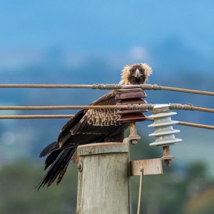
University of Tasmania researchers have developed a powerful risk mapping tool to help prevent fatal collisions between endangered wedge-tailed eagles and overhead power lines.
Dr James Pay and his team from the School of Natural Sciences analysed six years of GPS tracking data from 23 eagles for research published in the Journal of Applied Ecology. Using this data, they built a detailed model that predicts where eagles are most likely to cross power lines at low altitudes, which is where the risk of collision is highest.
The study found that eagles are more likely to make hazardous crossings in areas with a mix of open land and forest edges, particularly in remote regions. Seasonal changes also played a role, with risky crossings peaking in autumn and winter.
“Nearly 50 per cent of known collisions occurred on the 20 per cent of Tasmania’s power line network with the highest risk,” Dr Pay said.
Over 723,000 low-altitude eagle flight steps were analysed, with more than 9,400 power line crossings at risky altitudes.
To read the full article, click the link: Creating safer skies for Tasmania’s wedge-tailed eagles | University of Tasmania