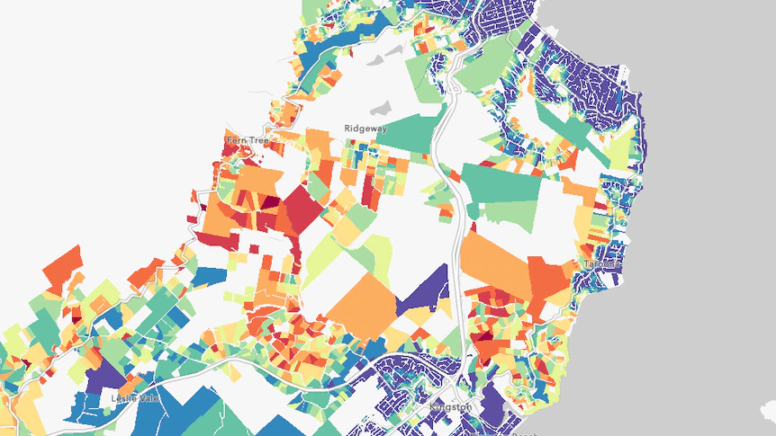
A new tool will allow Greater Hobart residents to examine the fire danger rating of their properties, with the ability to zoom in on a map on individual houses.
The Bushfire Exposure Index, which is part of a larger project funded by the National Emergency Management Agency, focuses on the council areas of Kingborough, Glenorchy and Hobart.
The report states that Tasmania is facing “increased bushfire threats, with prolonged fire seasons and an anticipated 40 per cent surge in extreme fire danger days”.
To read the rest of the article, click here.